Geolocate

越秀街道 topographic map

Interactive map

Click on the map to display elevation.

About this map

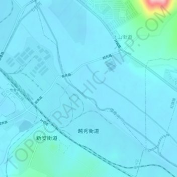
Name: 越秀街道 topographic map, elevation, terrain.

Location: 越秀街道, 新兴区, 七台河市, 黑龙江省, 中国 (45.79416 130.89104 45.82378 130.92684)

Average elevation: 172 m

Minimum elevation: 160 m

Maximum elevation: 321 m

Other topographic maps

Click on a map to view its topography, its elevation and its terrain.

中国 > 黑龙江省 > 七台河市

水, 东胜街道, 新富街道, 茄子河区, 七台河市, 黑龙江省, 154600, 中国

Average elevation: 208 m

勃利县

中国 > 黑龙江省 > 七台河市

勃利县, 七台河市, 黑龙江省, 154600, 中国

Average elevation: 299 m

茄子河区

中国 > 黑龙江省 > 七台河市

茄子河区, 七台河市, 黑龙江省, 154600, 中国

Average elevation: 267 m

新兴区

中国 > 黑龙江省 > 七台河市

新兴区, 七台河市, 黑龙江省, 154600, 中国

Average elevation: 268 m

龙头村

中国 > 黑龙江省 > 七台河市 > 龙头村

龙头村, 七台河市, 黑龙江省, 中国

Average elevation: 158 m

七台河市

中国 > 黑龙江省 > 七台河市

七台河市, 桃山区, 七台河市, 黑龙江省, 中国

Average elevation: 269 m