
向阳区 topographic map
Interactive map
Click on the map to display elevation.
About this map
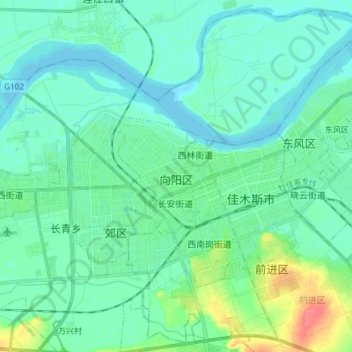
Name: 向阳区 topographic map, elevation, terrain.
Location: 向阳区, 佳木斯市, 黑龙江省, 154000, 中国 (46.76173 130.27588 46.85856 130.42556)
Average elevation: 85 m
Minimum elevation: 73 m
Maximum elevation: 136 m
Other topographic maps
Click on a map to view its topography, its elevation and its terrain.