
马桥河镇 topographic map
Interactive map
Click on the map to display elevation.
About this map
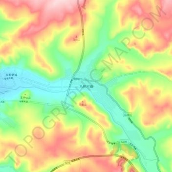
Name: 马桥河镇 topographic map, elevation, terrain.
Location: 马桥河镇, 穆棱市, 牡丹江市, 黑龙江省, 中国 (44.64839 130.49208 44.72839 130.57208)
Average elevation: 410 m
Minimum elevation: 300 m
Maximum elevation: 542 m
Other topographic maps
Click on a map to view its topography, its elevation and its terrain.