
麻山区 topographic map
Interactive map
Click on the map to display elevation.
About this map
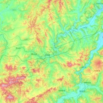
Name: 麻山区 topographic map, elevation, terrain.
Location: 麻山区, 鸡西市, 黑龙江省, 158180, 中国 (45.05173 130.39110 45.38168 130.68083)
Average elevation: 366 m
Minimum elevation: 204 m
Maximum elevation: 717 m
Other topographic maps
Click on a map to view its topography, its elevation and its terrain.