
鹤岗市 topographic map
Interactive map
Click on the map to display elevation.
About this map
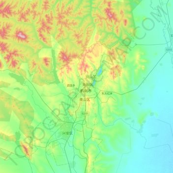
Name: 鹤岗市 topographic map, elevation, terrain.
Location: 鹤岗市, 黑龙江省, 中国 (47.16886 130.12169 47.48886 130.44169)
Average elevation: 166 m
Minimum elevation: 76 m
Maximum elevation: 424 m
Other topographic maps
Click on a map to view its topography, its elevation and its terrain.