
高岭镇 topographic map
Interactive map
Click on the map to display elevation.
About this map
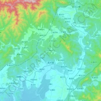
Name: 高岭镇 topographic map, elevation, terrain.
Location: 高岭镇, 密云区, 北京市, 中国 (40.54210 117.01551 40.70049 117.17586)
Average elevation: 297 m
Minimum elevation: 141 m
Maximum elevation: 1,124 m
Other topographic maps
Click on a map to view its topography, its elevation and its terrain.