
古北口镇 topographic map
Interactive map
Click on the map to display elevation.
About this map
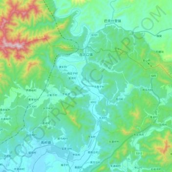
Name: 古北口镇 topographic map, elevation, terrain.
Location: 古北口镇, 密云区, 北京市, 中国 (40.61096 117.06605 40.70619 117.29248)
Average elevation: 337 m
Minimum elevation: 152 m
Maximum elevation: 1,119 m
Other topographic maps
Click on a map to view its topography, its elevation and its terrain.