
果园街道 topographic map
Interactive map
Click on the map to display elevation.
About this map
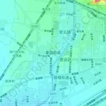
Name: 果园街道 topographic map, elevation, terrain.
Location: 果园街道, 密云区, 北京市, 中国 (40.35432 116.80599 40.40131 116.84203)
Average elevation: 74 m
Minimum elevation: 60 m
Maximum elevation: 177 m
Other topographic maps
Click on a map to view its topography, its elevation and its terrain.