
Make a donation
Norway topographic map
Click on the map to display elevation.
Make a donation
Norway
Little has been found dating from the early Iron Age (the last 500 years BC). The dead were cremated, and their graves contain few burial goods. During the first four centuries AD, the people of Norway were in contact with Roman-occupied Gaul. About 70 Roman bronze cauldrons, often used as burial urns, have been found. Contact with the civilised countries farther south brought a knowledge of runes; the oldest known Norwegian runic inscription dates from the third century. At this time, the amount of settled area in the country increased, a development that can be traced by coordinated studies of topography, archaeology, and place-names. The oldest root names, such as nes, vik, and bø ("cape," "bay," and "farm"), are of great antiquity, dating perhaps from the Bronze Age, whereas the earliest of the groups of compound names with the suffixes vin ("meadow") or heim ("settlement"), as in Bjǫrgvin (Bergen) or Sǿheim (Seim), usually date from the first century AD.
Make a donation
About this map
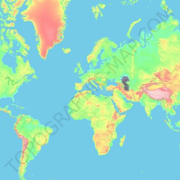
Name: Norway topographic map, elevation, terrain.
Location: Norway (-54.65400 -9.68463 81.02802 34.68891)
Average elevation: 293 m
Minimum elevation: -30 m
Maximum elevation: 6,646 m
Make a donation
Other topographic maps
Click on a map to view its topography, its elevation and its terrain.
Golan Heights
The plateau that Israel controls is part of a larger area of volcanic basalt fields stretching north and east that were created in a series of volcanic eruptions that began recently in geological terms, almost 4 million years ago. The rock forming the mountainous area in the northern Golan Heights, descending…
Average elevation: 406 m
Tiberias
Tiberias is located on the shore of the Sea of Galilee and the western slopes of the Jordan Rift Valley overlooking the lake, in the elevation range of −200 to 200 metres (−660–660 feet). Tiberias has a climate that borders a Hot-summer Mediterranean climate (koppen Csa) and a Hot Semi-arid climate…
Average elevation: -78 m
Make a donation
Make a donation
Make a donation
Modiin-Maccabim-Reut
הנחלים HaNechalim – The Rivers (Safdie) and משואה Masuah – Beacon (Givat C) are located towards the west of the city, and were planned by architect Moshe Safdie. Located in these neighborhoods are five commercial centers, a secondary school and three primary schools. The central street names are…
Average elevation: 240 m
Kiryat Shmona
Kiryat Shmona is located in the Finger of the Galilee next to Hula Valley, about 5 kilometres (3 miles) south and 2 km (1 mile) east of the Israel–Lebanon border. Its elevation is about 150 metres (492 feet) above sea level.
Average elevation: 236 m
Make a donation
Make a donation
Mitzpe Ramon
Mitzpe Ramon (Hebrew: מִצְפֵּה רָמוֹן, Ramon Lookout; Arabic: متسبي رمون) is a local council in the Negev desert of southern Israel. It is situated on the northern ridge at an elevation of 860 meters (2,800 feet) overlooking the world's largest erosion cirque, known as the Makhtesh…
Average elevation: 782 m
Make a donation
Make a donation
Nimrod Fortress National Park
Israel > North District > Golan Regional Council
Average elevation: 674 m
Make a donation
Caesarea National Park
Israel > Haifa District > Hof HaCarmel Regional Council > Caesarea
Average elevation: 8 m
Make a donation
Nahal Taninim
Israel > Haifa District > Hof HaCarmel Regional Council > Caesarea
Average elevation: 32 m
Make a donation
Matmor Mountains lookout
Israel > South District > Ramat Negev Regional Council
Average elevation: 410 m
Make a donation
Har Bental
Israel > North District > Golan Regional Council
Mount Bental (Arabic: جبل بنطل, جبل الغرام / ALA-LC: Jabal al-Gharam / "Mountain of Lust" "Jabal Bental"; Hebrew: הר בנטל, Har Bental, "Mount Bental" (lit. "Son of Dew") is a dormant volcano in the North-Eastern part of the Golan Heights, It extends to an elevation of 1,171 meters above sea level.
Average elevation: 975 m
Mount Meron
Israel > North District > Merom HaGalil Regional Council
In 1965, an 84,000-dunam nature reserve was declared. An additional 1,199 dunams were declared part of the reserve in 2005. It is the highest reserve in Israel, at an altitude of 1,204 meters above sea level, and the largest reserve in the north of the country.
Average elevation: 943 m
Make a donation
2236 Mt. Hermon
Israel > North District > Golan Regional Council
Mount Hermon (Arabic: جبل الشيخ or جبل حرمون / ALA-LC: Jabal al-Shaykh ('Mountain of the Sheikh') or Jabal Haramun; Hebrew: הַר חֶרְמוֹן, Har Ḥermōn) is a mountain cluster constituting the southern end of the Anti-Lebanon mountain range. Its summit straddles the border between…
Average elevation: 2,016 m
Make a donation
Make a donation
Make a donation
Make a donation
Make a donation
Shusha
Shusha (Azerbaijani: Şuşa, (listen)) or Shushi (Armenian: Շուշի) is a city in Azerbaijan, in the region of Nagorno-Karabakh. Situated at an altitude of 1.4–1.8 kilometres (4,600–5,900 ft) in the Karabakh mountains, the city was a mountain resort in the Soviet era.
Average elevation: 1,252 m
Make a donation
Make a donation
Make a donation
Mestia
Georgia > Samegrelo-Upper Svaneti > Mestia Municipality
Mestia (Georgian: მესტია IPA: [mɛstʼiɑ]) is a highland townlet (daba) in northwest Georgia, at an elevation of 1,500 metres (4,921 feet) in the Caucasus Mountains.
Average elevation: 1,770 m
Hotazel
South Africa > Northern Cape > John Taolo Gaetsewe District Municipality > Joe Morolong Local Municipality
Average elevation: 1,060 m
Sendafa
Sendafa (Oromo: Sandafaa; Amharic: ሰንዳፋ) is a town in central Ethiopia. It also serves as a separate district in the Oromia Region of Ethiopia, and its name is taken from the Oromo name for a kind of thick, jointed grass or reed which grows in swampy areas. Located in the Oromia Special Zone…
Average elevation: 2,594 m
Austin
United States > Nevada > Lander County
Austin is an unincorporated small town in, and former county seat of, Lander County, Nevada, United States. In 2020, the census-designated place of Austin had a population of 167. It is located on the western slopes of the Toiyabe Range at an elevation of 6,575 feet (2,004 m). U.S. Route 50 passes through the…
Average elevation: 2,061 m
Make a donation
Mount Santo Tomas
Due to its high elevation, several communications and broadcasting companies constructed relay stations at the summit.
Average elevation: 1,741 m
Make a donation
Brasília
Brazil > Federal District > Região Integrada de Desenvolvimento do Distrito Federal e Entorno
The city sits at an elevation of 1,000 metres (3,300 ft) and more, high on the Brazilian Highlands in the country's center-western region. Paranoá Lake, a large artificial lake, was built to increase the amount of water available and to maintain the region's humidity. It has a marina, and hosts wakeboarders…
Average elevation: 1,084 m
Bhuj
India > Gujarat > Bhuj Taluka
Bhuj has an average elevation of 110 metres or 360 feet. On the eastern side of the city is a hill known as Bhujia Hill, on which there is a Bhujia Fort, that separates Bhuj city and Madhapar town (considered one of the richest villages in Asia). It has two lakes namely Hamirsar Lake and Deshadsar (દેેેશળસર).
Average elevation: 130 m
Make a donation
Thrissur
Thrissur is the headquarters of Thrissur district, in the center of the Indian state of Kerala. The city is 75 km north-east of Kochi, 133 km south-west of Coimbatore, 124 km south-east of Kozhikode and 151 km north of Changanacherry. The city is located in a hillock called Thekkinkadu Maidan which is the…
Average elevation: 36 m
Neftchala
Throughout its history, Neftçala has suffered from floods because of its proximity to the river and most of the town's relatively low elevation.
Average elevation: -27 m
Make a donation
Baltic Sea
Average elevation: 0 m
Make a donation