
杭锦旗 topographic map
Interactive map
Click on the map to display elevation.
About this map
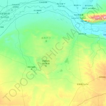
Name: 杭锦旗 topographic map, elevation, terrain.
Location: 杭锦旗, 鄂尔多斯市, 内蒙古自治区, 中国 (39.53858 107.52003 40.93858 108.92003)
Average elevation: 1,230 m
Minimum elevation: 1,012 m
Maximum elevation: 2,283 m
Other topographic maps
Click on a map to view its topography, its elevation and its terrain.