
明水河镇 topographic map
Interactive map
Click on the map to display elevation.
About this map
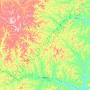
Name: 明水河镇 topographic map, elevation, terrain.
Location: 明水河镇, 阿尔山市, 兴安盟, 内蒙古自治区, 中国 (46.65918 120.44628 47.23271 121.39675)
Average elevation: 927 m
Minimum elevation: 492 m
Maximum elevation: 1,742 m
Other topographic maps
Click on a map to view its topography, its elevation and its terrain.