
大井镇 topographic map
Interactive map
Click on the map to display elevation.
About this map
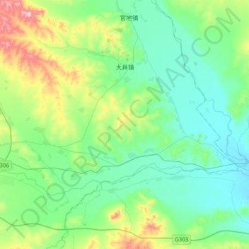
Name: 大井镇 topographic map, elevation, terrain.
Location: 大井镇, 林西县, 赤峰市, 内蒙古自治区, 中国 (43.51783 118.11529 43.73922 118.41180)
Average elevation: 772 m
Minimum elevation: 668 m
Maximum elevation: 1,125 m
Other topographic maps
Click on a map to view its topography, its elevation and its terrain.