
巴林左旗 topographic map
Interactive map
Click on the map to display elevation.
About this map
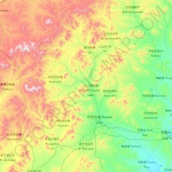
Name: 巴林左旗 topographic map, elevation, terrain.
Location: 巴林左旗, 赤峰市, 内蒙古自治区, 中国 (43.61630 118.73397 44.78238 119.80762)
Average elevation: 825 m
Minimum elevation: 364 m
Maximum elevation: 1,927 m
Other topographic maps
Click on a map to view its topography, its elevation and its terrain.