
Norway topographic map
Interactive map
Click on the map to display elevation.
Norway
Little has been found dating from the early Iron Age (the last 500 years BC). The dead were cremated, and their graves contain few burial goods. During the first four centuries AD, the people of Norway were in contact with Roman-occupied Gaul. About 70 Roman bronze cauldrons, often used as burial urns, have been found. Contact with the civilised countries farther south brought a knowledge of runes; the oldest known Norwegian runic inscription dates from the third century. At this time, the amount of settled area in the country increased, a development that can be traced by coordinated studies of topography, archaeology, and place-names. The oldest root names, such as nes, vik, and bø ("cape," "bay," and "farm"), are of great antiquity, dating perhaps from the Bronze Age, whereas the earliest of the groups of compound names with the suffixes vin ("meadow") or heim ("settlement"), as in Bjǫrgvin (Bergen) or Sǿheim (Seim), usually date from the first century AD.
About this map
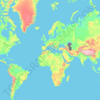
Name: Norway topographic map, elevation, terrain.
Location: Norway (-54.65400 -9.68463 81.02802 34.68891)
Average elevation: 293 m
Minimum elevation: -30 m
Maximum elevation: 6,646 m
Other topographic maps
Click on a map to view its topography, its elevation and its terrain.
Waterton Park
Canada > Alberta > Improvement District No. 04
It is located at the southwestern terminus of Highway 5, approximately 54 kilometres (34 mi) west of the Town of Cardston and 55 kilometres (34 mi) south of the Town of Pincher Creek. This hamlet is north of Glacier National Park in Montana. It has an elevation of 1,280 metres (4,200 ft).
Average elevation: 1,456 m
Elk Grove
United States > Pennsylvania > Columbia County > Sugarloaf Township
Average elevation: 534 m
Adimali
Adimaly generally has a cool climate throughout the year, typical of the higher altitudes, though not as cold as Munnar. Temperatures rarely exceed 26 degrees and never drop below 10 degrees as it usually stays around 17-24 degrees. December and January are cooler than other months. Adimaly is a place with…
Average elevation: 786 m
Erattupetta
Erattupetta can be easily accessed from north Kerala via the Angamaly-Muvattupuzha-Thodupuzha-Muttom route. It is also well connected to Tamil Nadu via the Kottayam-Kumali Road(KK Road) to Madurai, through the nearest town, Mundakkayam, via Parathanam, which is 27 kilometers from Erattupetta. The town has an…
Average elevation: 78 m
Thiruvananthapuram
India > Kerala > Thiruvananthapuram
Thiruvananthapuram is built on seven hills by the seashore and is at 8°30′N 76°54′E / 8.5°N 76.9°E / 8.5; 76.9 on the west coast, near the southern tip of mainland India. The city is on the west coast of India and is bounded by the Laccadive Sea to its west and the Western Ghats to its east.…
Average elevation: 33 m
Thiruvalla
India > Kerala > Thiruvalla
Thiruvalla lies at an altitude of 14 meters above sea level, along the north bank of the Manimala river. Thiruvalla is criss-crossed by many natural canals (known as "thodu" in Malayalam) like Chanthathodu and Manippuzha.
Average elevation: 10 m
Kattappana
The average elevation of Kattappana Municipality is 950 m above sea level.
Average elevation: 950 m
Uzhavoor
The climate in this region is moderate and pleasant. Uzhavoor has an average elevation of 4 metres from the sea level. According to the division of places in Kerala based on altitudes, Uzhavoor is classified as being a midland area. The general soil of the area is Alluvial soil. The area is very and well…
Average elevation: 92 m
Ernakulam
India > Kerala > Kanayannur
The Ernakulam District is situated in Central Kerala in India. Ernakulam is located at the geographic coordinates of 9°58′53.8″N 76°17′59.6″E / 9.981611°N 76.299889°E / 9.981611; 76.299889 and at an elevation of 22.36 m (73.4 ft) above the mean sea level.
Average elevation: 6 m
Australian Garden
United States > California > Santa Cruz County > Santa Cruz
Average elevation: 131 m
Australian Garden - Royal Botanic Gardens Cranbourne
Australia > Victoria > Melbourne
Average elevation: 70 m
Auckland
The Auckland Volcanic Field has contributed greatly to the growth and prosperity of the Auckland region since the area was settled by humans. Initially, the maunga (scoria cones) were occupied and established as pā (fortified settlements) by Māori due to the strategic advantage their elevation provided in…
Average elevation: 32 m
Bagalkote
India > Karnataka > Bagalakote taluk
Bagalkote, is a city in the state of Karnataka, India, which is also the headquarters of Bagalkot district. It is situated on branch of River Ghataprabha, The population of the urban agglomeration was 111,933 according to the provisional results of 2011 national census of India, the city is spread over an area…
Average elevation: 556 m
Jengish Chokusu
China > Xinjiang > Onsu County
Jengish Chokusu or Victory Peak is the highest mountain in the Tian Shan mountain system in Central Asia at 7,439 metres (24,406 ft). It lies on the China–Kyrgyzstan border between the Ak-Suu District in the Issyk-Kul Region of far Eastern Kyrgyzstan and Wensu County, Xinjiang, China. It is part of the…
Average elevation: 6,681 m